


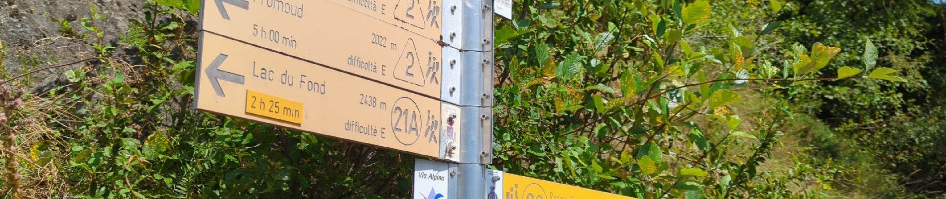
Étape 4 - Refuge Deffeyes - Planaval

i20
User
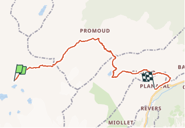

Length
16.2 km

Max alt
2855 m

Uphill gradient
1113 m
Km-Effort
34 km

Min alt
1534 m

Downhill gradient
2043 m
Boucle
No
Creation date :
2023-08-14 04:42:36.388
Updated on :
2023-08-14 14:14:19.958
8h44
Difficulty : Very difficult

FREE GPS app for hiking
 SityTrail
IGN / Geographical institutes
SityTrail Plus
The world is yours!
About
Trail Walking of 16.2 km to be discovered at Aosta Valley, Unknown, La Thuile. This trail is proposed by i20.
Photos


Positioning
Country:
Italy
Region :
Aosta Valley
Department/Province :
Unknown
Municipality :
La Thuile
Location:
Unknown
Start:(Dec)
Start:(UTM)
343146 ; 5059960 (32T) N.
Comments